ride
The Flying J Ranch Lariat Loop
A shady, intermediate lariat on the Shadow Pine Loop at Flying J Ranch: loose Buffalo Creek style dirt, mostly tree cover, and a four-mile loop you can just ride twice.
- Date
- 2026-07-25
- Region
- Colorado
- Country
- USA
- Distance
- 4.0 mi
- Elevation gain
- 322 ft
- Elevation range
- 8028–8251 ft
- Technical difficulty
- Intermediate
Not every ride has to be a project.
Some days you want dirt, shade, and a loop you already know how it ends.
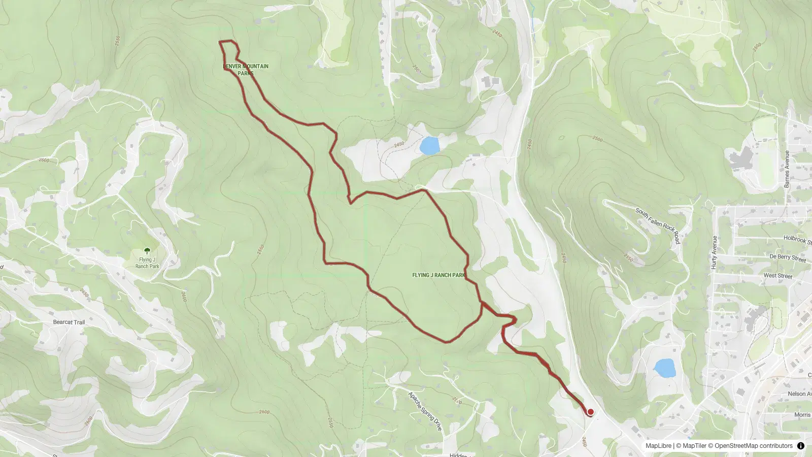
Flying J Ranch is a small Jefferson County Open Space park up near Conifer, and it turns out to be an excellent version of that ride. The main trail is the Shadow Pine Loop. I parked at the south trailhead and built a lariat out of it: a short connector out to the loop, the loop itself, and the same short connector back.
The GPX came out to:
- About four miles
- A little over 300 feet of climbing
Call it four miles.
If that sounds short, that is the point. If it turns out to be too short, you do it again.
The Route
The ride starts at the south trailhead.
From the lot, take the short connector up until it meets the Shadow Pine Loop. This is the stem of the lariat, and it is the only part you ride twice.
When the connector reaches the loop, pick a direction. Either one works. I ran it clockwise, and I would do it clockwise again, but the trail does not care and neither should you.
Ride the loop all the way around, arrive back at the same junction, and drop back down the connector to the car.
That is the whole route.
The navigation strategy, if you want one:
Ride the connector up, go around the loop, come back down the connector.
There is nothing to overthink here. The signs say Shadow Pine Loop, the loop is a loop, and you are never far from where you started.
Buffalo Creek Without the Drive, Sort Of
The surface is the interesting part.
Flying J is loose, sandy, decomposed granite. Kitty litter. If you have ridden Buffalo Creek, you already know the feeling: a firm enough line most of the time, with a top layer that slides just as you ask the rear wheel for something specific.
That is why I think this is a genuinely good warm-up for Buffalo Creek.
If you are not ready to commit to a full Buffalo Creek day, or you just want to remember how that dirt behaves before you drive out there, this is a much smaller way to practice the same skills. Same traction lessons, same braking lessons, a fraction of the mileage.
The other thing worth knowing is that this trail has more roots than rocks.
That sounds minor. It is not. Most of the trails in Golden proper are rocky, and roots are not especially common down there, so a lot of Front Range riders do not get much practice on them. Roots make the bike behave differently. They are slick when they are the least bit damp, they kick the front wheel sideways if you hit them at the wrong angle, and they reward a light, loose upper body instead of the muscle-through-it approach that rocks tend to forgive. It is a different skill, and this is a low-stakes place to work on it.
I would call it a solid intermediate ride. It is not beginner-smooth bike path, and it is not a full afternoon of paying for elevation. It sits comfortably in between, which is a nice place for a trail to sit.
Mostly Shade, Which Is the Point
Here is the other reason I keep this one in my pocket.
It is mostly shade.
More shade than sun, anyway, which is not something I can say about a lot of the exposed foothills riding closer to Golden. There are open, sunnier stretches, and the beetle-kill pines have thinned the canopy in places, but the general experience is trees.
That makes it a good hot-day ride. When the mesa tops around Golden have turned into a heat lamp, this loop is sitting up higher and under cover, and it is a much more pleasant place to turn the pedals.
Who You Will Actually See
For a trail this close to the Front Range, it stays quiet.
Even on weekends, it does not get slammed. The people you do meet are mostly:
- Dog walkers
- Modest hikers
- The occasional trail runner
- Very occasionally, another mountain biker
Not many hikers in the serious-boots sense. Not many bikes at all, honestly.
It is still a shared trail, so the usual applies. Yield to people on foot, slow down around dogs and strollers, and announce yourself before you come around a blind, shady corner at a family out for a walk. The loop is four miles. Losing a few seconds to be polite is not going to ruin your day.
Four Miles Is a Suggestion
The best thing about a lariat is that the decision point comes to you.
When you finish the loop, you are right back at the top of the connector. If four miles felt like enough, drop down to the car. If it did not, turn around and ride the loop again. Nothing about the route forces you to be done.
It is a good after-work ride, a good hot-day ride, and an easy reach from the west side of Golden. It is short enough to be low-commitment and loose enough to be useful practice for the bigger loose stuff.
Ride it once.
If you are still smiling at the junction, ride it twice.
- colorado
- conifer
- flying-j-ranch
- shadow-pine-loop
- mountain-bike
- single-speed
- intermediate